A map without labels
March 16, 2025 ・ Blog
In the pursuit of working on something that I’m not quite ready to share yet, I found myself needing to create a map of a town without any labels. No road names, no area names, just the roads and paths. Turns out that, due to the wealth of geographic data that’s freely available to all, this is both entirely possible to create and difficult to do without a lot of blind fiddling, so I put together a quick guide to the solution I discovered.
-
Download QGIS. This software connects to map data sources and displays maps based on them. It seems extremely powerful. We will be using an ounce of that power.
-
We need to select a data source for our map that holds labels separately to the roads and other features. I messed around with OpenStreetMap for ages before realising that it serves images that have the labels baked in. This post saved the day, because it features exactly what I needed and explained how to access it. Thanks, Alexander Orlovsky!
-
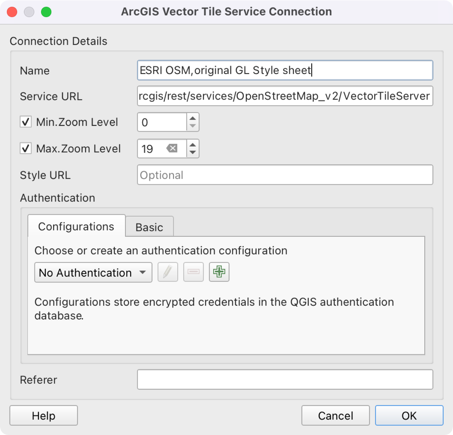
In the Browser in the left panel, right click on Vector Tiles and select “New ArcGIS Vector Tile Service Connection”. Copy the info in the image below. Here’s the all-important “Service URL”: https://basemaps.arcgis.com/arcgis/rest/services/OpenStreetMap_v2/VectorTileServer
-
Find and display the place on the map that you want to depict.
-
Now it’s time to sweep the map clear of labels with the Layer Styling panel. Go to View > Panels > Layer Styling to open it on the right of the screen. We’ll be using two of the tabs. Symbology takes care of icons and other images, and Labels does the rest.
-
Let’s do Labels first. I found it useful to select “Visible rules only” because the list is very long, and I deselected every single one. I couldn’t find an option to select en masse so I selected the first then pressed space to deselect and cursor-down to select the next, and repeat. Deselect “Live update” to prevent it refreshing the map every time.
-
Next, Symbology. Again, “Visible rules only” helps. Here you’ll need to be more sparing with the deselecting, because it includes roads and lots more besides. You can use the search to find hospital symbols and other similarly obvious elements. Note that different things appear in this dataset depending on zoom level.
-
I didn’t do this, but you can also change colours in Symbology. Because there is an overwhelming number of different kinds of map things, I left them all as is.
-
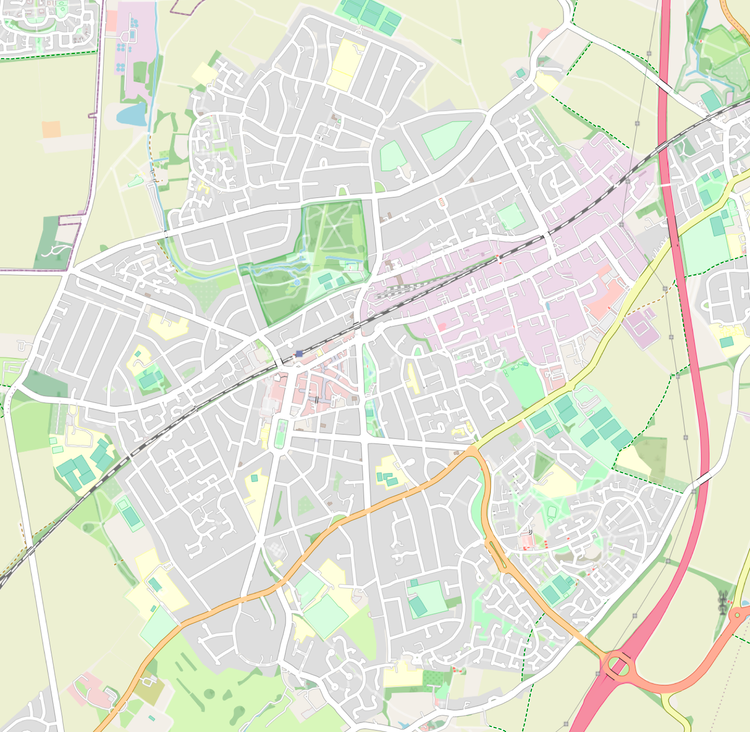
I guess QGIS can output maps in various formats, but I don’t know what or how because I just screenshotted mine. I don’t need high quality. Here’s the result:
I will explain what all this relates to sometime soon! I am pretty excited about it.